オーストラリア国立博物館所蔵
Creator: Arrowsmith, John, 1790-1873
Title: Japan, the islands of Loochoo & Formosa, and the maritime provinces of China with the tract of the Morrison's voyage in 1837 / J. Arrowsmith, Lith
Japan, the islands of Loochoo & Formosa, and the maritime provinces of China with the tract of the Morrison's voyage in 1837 [cartographic material]

Map of Nippon [i.e. Japan] and its provinces as well as the Loochoo [i.e. Ryukyu] Islands and to the west the Kingdom of Correa [i.e. Korea], Formosa Island [i.e. Taiwan] and the northeast portion of China and its provinces. The map features a time-dated route in yellow of an unarmed ship the Morrison used in an attempt to make peaceful contact with Japanese authorities hostile to the West. In July of 1837 several American missionaries and an American firm (D.W.C. Olyphant and Co.) in Canton, China dispatched the Morrison from Macau, China to Yedo [i.e. Tokyo] Bay.
The mission, led by Charles W. King, an American merchant, was to return several Japanese castaways and through this humanitarian gesture hopefully cause the Japanese to open the country to Western trade and Christianity.
The Dutch were aware of the Morrison mission and gave the Japanese advance notice of the impending visit. The Japanese promptly signaled the visit would not be allowed when the ship reached Japanese waters. The Morrison was fired on by shore batteries while sitting off Uraga [i.e. Yokohama] and again in the Bay of Kagoshima. One shot hit the Morrison but caused no injury and only minor damage to the ship. The mission was abandoned. Some relief is shown by hachures.
At the top right corner of sheet: Select Committee on Commercial Relations with China.
At the bottom right corner of sheet: Ordered by the House of Commons to be printed, 12th July 1847.
At the bottom center of sheet: "(No. 654)"
Includes legend entitled: Chinese & Japanese Terms.

++++++
モリソン號航海誌(米国ミシガン大学所蔵)
archive.org
The claims of Japan and Malaysia upon Christendom, exhibited in notes of voyages made in 1837, from Canton, in the ship Morrison and brig Himmaleh

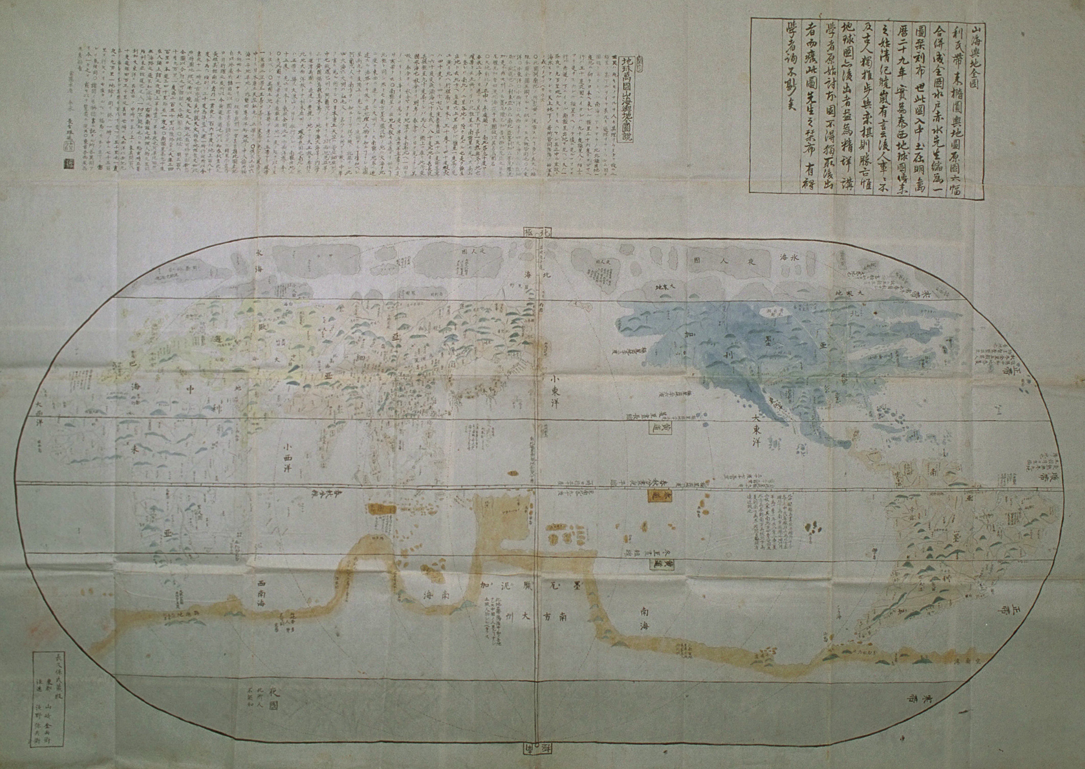
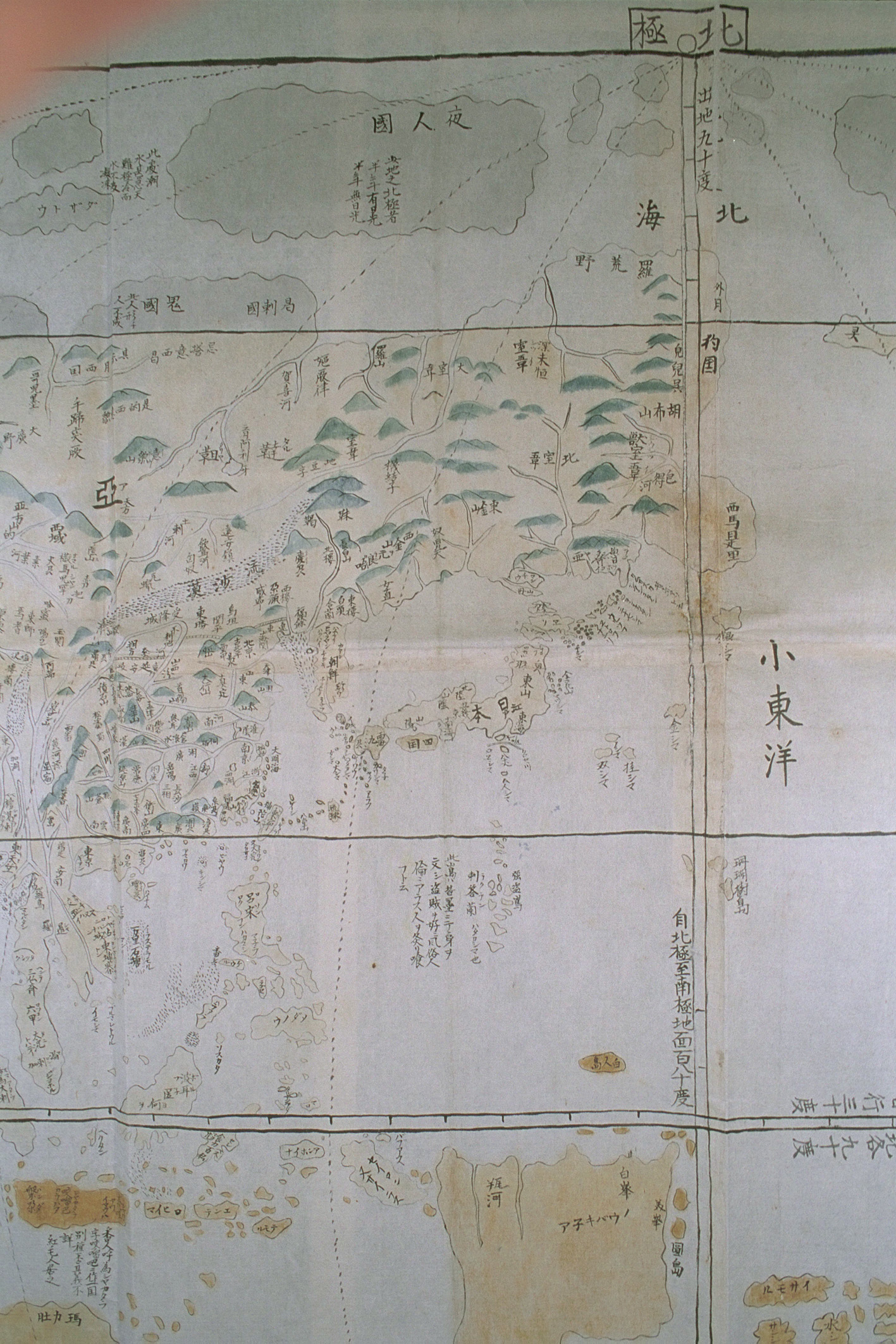
日本人の領域であることを示す「Sima」についての認識
台湾島におけるオランダと日本
チャイナ人には台湾島の東の島々どころか台湾島の奥地へ進出し東海岸に到達する能力さえ無かったと評価されている。欧米の地図表記と併せ見れば台湾島の東海岸から東方は日本の勢力範囲というのが、国際的認識だったと断言できる。

日本の勢力範囲

八重山諸島に関する記述部分

参考拡大図

【天保8年米国「琉球は正真正銘(really and truly)日本に属する」】
薩摩支配について
琉球の薩摩支配は既に欧州に知られており、「琉球とチャイナとの関係は名目的で儀礼的な関係であるのに対し、琉球は正真正銘(really and truly)日本に属する」との記載がある。
https://archive.org/stream/claimsjapanandm00kinggoog#page/n124/mode/2up

後日、下記部分を個別に取り上げようと、長い間下書きに置いたままだったのですが公開します。
米国商船のモリソン号航海日誌(上の画像左頁)には
"The connection between Loochoo and China is merely nominal or ceremonial, and that the island is really and truly a dependency of Japan"
「琉球とチャイナとの関係は名目的で儀礼的な関係であるのに対し、琉球は正真正銘(really and truly)日本に属する」との記載があります。
なお、このブログ最上部の航路地図はアイルランドの地図です。