Elementary geography, for primary classes
by Arnold Guyot, Mary Howe Smith
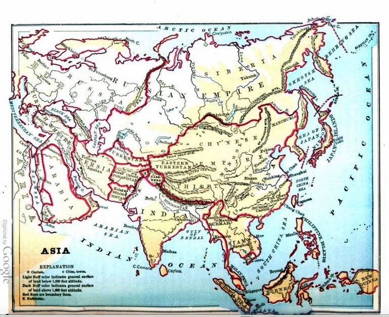
1879年の米国の「小学下級生向け 初歩の地理」の画像と所在のアドレスを下記に張り付ける。1879年とは、明治維新から11年、西南戦争から2年。琉球藩が沖縄県となり廃藩置県がやっと完了したばかりである。
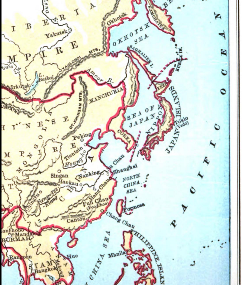
その時期に既に尖閣諸島は日本として地図に描かれている事実がある。
なお、Guyot氏の説明は既に述べたので割愛する。
Asia Map Studies と言うページ
https://archive.org/stream/elementarygeogr00smitgoog#page/n90/mode/2up

便宜のため90度回転画像を貼り付ける。


日本で言えば、小学生の3,4年生にあたる米国の "primary classes" で、”Japan Sea” の名前と位置を学んでいることも特筆できるだろう。
また日本については。日本の領土が赤い縁取りがされているうえ、それに加えて領海線ともいえる赤い点線が付されている。これは他のアジア諸国が領土線のみの表記であることと対照的であり、特段の意味・・・日本がその当時において、米国と太平洋を挟んでその領域を接している国だと意識されていたという意味・・・があるに違いない。
その証拠に、日本の国境線以外の赤い点線は、ロシアと米国の国境線(1867年)が引かれているだけである。
対照的に南シナ海には「領海線ともいえる赤い点線」は存在しない。
19世紀の欧米諸国、東アジア貿易に係わる国々の認識を表す地図として、尖閣の西側に国境線を引く1804年・1868年のシュティーラー氏の流れをくむ地図は、これからも大量に発見されることだろう。
Like Stieler's Atlas of 1804 and 1868, many maps which depicted the Senkaku Islands as a part of Japan will be found from now on, because this recognition was common among the nations trading with East Asian countries at the time, "Age of Steam".
日本付近の拡大図

その他の注目点:
地図の理解を深める「設問」(ASIA MAP STUDIES)の中に、In what part of the Empire is China? というのがあります。清王朝が支配している一部分が支那であるということを教えている。つまり、Chinese Empire と China は異なるという認識が見受けられる。
2016-6-15 『対照的に南シナ海には「領海線ともいえる赤い点線」は存在しない。』の1行を追加